
Transekur Sargassum Planner
Sargassum in the Dominican Republic: which coasts are clearer by month
Quick answer: In October, the Dominican Republic's east- and northeast-facing resort coasts remain in the active part of sargassum season: the planning model puts them at elevated concern. Bayahibe, La Romana and the southwest usually carry lower exposure, but no beach can be guaranteed clear on a particular day.
Satellite signal · NOAA
ExperimentalOffshore inundation-risk product for 23 October 2026: of the 26 rated coastal stretches, 5 High, 15 Elevated, 2 Moderate and 4 Lower.
Latest reading on file · auto-updates daily from NOAA, refreshed while you read. A 7-day offshore proxy, not a beach report — it does not change the Planning Index below. Source: NOAA AOML / CoastWatch Caribbean and Gulf of America Node with the University of South Florida. Experimental product, subject to validation by NOAA/AOML, NOAA CoastWatch/OceanWatch and USF.
- Seasonal model 1.0.0 (August 2026 edition)
- Satellite reading above: updated daily by NOAA
The Planning Index is a 0–100 comparative seasonal index — not a percentage probability, not a beach report, not a guarantee. The live NOAA satellite signal above is a separate offshore layer — it never changes these Planning Index colours.
Month
Sets the month and shows which kind of evidence applies at that lead time.
Searches destinations, named beaches and resorts in Transekur's transfer inventory. Resort results are provisional until the actual beach pin is reviewed.
- Lower0–19
- Moderate20–39
- Elevated40–59
- High60–100
- Unknown / insufficient datalive data missing or stale
- Not applicable — inland
- International airport
- Coast with no colour: no destination in this model (unrated, not "clear").
Layer shown: typical seasonal pattern · seasonal model 1.0.0 (August 2026 edition) · map colours are not driven by the live NOAA signal
Boundaries: geoBoundaries (Caribbean GeoPortal, 2020), CC BY 4.0 · Haiti context: Natural Earth · Web Mercator
Punta Cana: Elevated, Planning Index 41, October, typical year.
Planning result
Punta Cana
east coast · nearest airport PUJ · October, typical year
Elevated
Planning Index, 0–100. This is not a percentage probability.
- Why this coast has this baseline
- The island's eastern tip faces the open tropical Atlantic, so it is among the destinations most directly exposed to seasonal arrivals.
- Evidence shown
- Seasonal climatology: typical month × coast exposure. The live NOAA strip at the top of the page is a separate offshore signal — it does not feed this index. Beach-observation layers are not enabled yet.
- Confidence and freshness
- Editorial baseline, comparative only · seasonal model 1.0.0 (August 2026 edition) · live NOAA signal shown separately, not scored
- Cleanup and visitor-condition evidence
- No dated beach observation on file yet. Ask the hotel for same-day photographs of the exact beach section and whether barriers or daily collection are operating.
- Nearest practical airport
- Punta Cana International Airport (PUJ). VIP Fast Track is offered at PUJ — see how it works.
Lower-exposure or inland alternatives for October
Month by month: Punta Cana
Planning Index, 0–100 · not a probability
| Month | Planning Index | Category |
|---|---|---|
| January | 14 | Lower |
| February | 17 | Lower |
| March | 28 | Moderate |
| April | 44 | Elevated |
| May | 66 | High |
| June | 87 | High |
| July | 92 | High |
| August | 81 | High |
| September | 64 | High |
| October | 41 | Elevated |
| November | 23 | Moderate |
| December | 15 | Lower |
Every destination, every month
Planning Index, 0–100 · inland shows “—” (not applicable)
| Destination | Jan | Feb | Mar | Apr | May | Jun | Jul | Aug | Sep | Oct | Nov | Dec |
|---|---|---|---|---|---|---|---|---|---|---|---|---|
| East and northeast | ||||||||||||
| 14 Lower | 17 Lower | 28 Moderate | 44 Elevated | 66 High | 87 High | 92 High | 81 High | 64 High | 41 Elevated | 23 Moderate | 15 Lower | |
| 14 Lower | 17 Lower | 29 Moderate | 46 Elevated | 69 High | 91 High | 96 High | 84 High | 67 High | 43 Elevated | 24 Moderate | 15 Lower | |
| 12 Lower | 15 Lower | 25 Moderate | 39 Moderate | 59 Elevated | 78 High | 82 High | 72 High | 57 Elevated | 37 Moderate | 21 Moderate | 13 Lower | |
| 14 Lower | 17 Lower | 28 Moderate | 45 Elevated | 68 High | 89 High | 94 High | 83 High | 66 High | 42 Elevated | 24 Moderate | 15 Lower | |
| 14 Lower | 16 Lower | 27 Moderate | 44 Elevated | 66 High | 86 High | 91 High | 80 High | 64 High | 41 Elevated | 23 Moderate | 15 Lower | |
| 13 Lower | 15 Lower | 26 Moderate | 41 Elevated | 62 High | 82 High | 86 High | 76 High | 60 High | 39 Moderate | 22 Moderate | 14 Lower | |
| Southeast and Caribbean-facing east | ||||||||||||
| 6 Lower | 8 Lower | 13 Lower | 20 Moderate | 30 Moderate | 40 Elevated | 42 Elevated | 37 Moderate | 29 Moderate | 19 Lower | 11 Lower | 7 Lower | |
| 7 Lower | 9 Lower | 14 Lower | 23 Moderate | 35 Moderate | 46 Elevated | 48 Elevated | 42 Elevated | 34 Moderate | 22 Moderate | 12 Lower | 8 Lower | |
| 6 Lower | 7 Lower | 12 Lower | 19 Lower | 29 Moderate | 38 Moderate | 40 Elevated | 35 Moderate | 28 Moderate | 18 Lower | 10 Lower | 6 Lower | |
| 8 Lower | 9 Lower | 15 Lower | 24 Moderate | 36 Moderate | 48 Elevated | 50 Elevated | 44 Elevated | 35 Moderate | 23 Moderate | 13 Lower | 8 Lower | |
| South coast and capital corridor | ||||||||||||
| 7 Lower | 8 Lower | 14 Lower | 22 Moderate | 33 Moderate | 44 Elevated | 46 Elevated | 40 Elevated | 32 Moderate | 21 Moderate | 12 Lower | 7 Lower | |
| 6 Lower | 8 Lower | 13 Lower | 20 Moderate | 30 Moderate | 40 Elevated | 42 Elevated | 37 Moderate | 29 Moderate | 19 Lower | 11 Lower | 7 Lower | |
| 7 Lower | 8 Lower | 13 Lower | 21 Moderate | 32 Moderate | 42 Elevated | 44 Elevated | 39 Moderate | 31 Moderate | 20 Moderate | 11 Lower | 7 Lower | |
| South and southwest | ||||||||||||
| 5 Lower | 6 Lower | 11 Lower | 17 Lower | 25 Moderate | 33 Moderate | 35 Moderate | 31 Moderate | 25 Moderate | 16 Lower | 9 Lower | 6 Lower | |
| 5 Lower | 5 Lower | 9 Lower | 14 Lower | 22 Moderate | 29 Moderate | 30 Moderate | 26 Moderate | 21 Moderate | 14 Lower | 8 Lower | 5 Lower | |
| 4 Lower | 5 Lower | 8 Lower | 13 Lower | 20 Moderate | 27 Moderate | 28 Moderate | 25 Moderate | 20 Moderate | 13 Lower | 7 Lower | 4 Lower | |
| 3 Lower | 3 Lower | 5 Lower | 9 Lower | 13 Lower | 17 Lower | 18 Lower | 16 Lower | 13 Lower | 8 Lower | 5 Lower | 3 Lower | |
| Samaná Peninsula and bay | ||||||||||||
| 8 Lower | 10 Lower | 17 Lower | 26 Moderate | 40 Elevated | 52 Elevated | 55 Elevated | 48 Elevated | 39 Moderate | 25 Moderate | 14 Lower | 9 Lower | |
| 9 Lower | 10 Lower | 17 Lower | 28 Moderate | 42 Elevated | 55 Elevated | 58 Elevated | 51 Elevated | 41 Elevated | 26 Moderate | 15 Lower | 9 Lower | |
| 11 Lower | 13 Lower | 22 Moderate | 35 Moderate | 52 Elevated | 68 High | 72 High | 63 High | 50 Elevated | 32 Moderate | 18 Lower | 12 Lower | |
| 12 Lower | 14 Lower | 23 Moderate | 37 Moderate | 56 Elevated | 74 High | 78 High | 69 High | 55 Elevated | 35 Moderate | 20 Moderate | 12 Lower | |
| North and northwest | ||||||||||||
| 8 Lower | 10 Lower | 16 Lower | 26 Moderate | 39 Moderate | 51 Elevated | 54 Elevated | 48 Elevated | 38 Moderate | 24 Moderate | 14 Lower | 9 Lower | |
| 7 Lower | 8 Lower | 14 Lower | 22 Moderate | 33 Moderate | 44 Elevated | 46 Elevated | 40 Elevated | 32 Moderate | 21 Moderate | 12 Lower | 7 Lower | |
| 9 Lower | 10 Lower | 17 Lower | 28 Moderate | 42 Elevated | 55 Elevated | 58 Elevated | 51 Elevated | 41 Elevated | 26 Moderate | 15 Lower | 9 Lower | |
| 9 Lower | 11 Lower | 19 Lower | 30 Moderate | 45 Elevated | 59 Elevated | 62 High | 55 Elevated | 43 Elevated | 28 Moderate | 16 Lower | 10 Lower | |
| 5 Lower | 6 Lower | 11 Lower | 17 Lower | 26 Moderate | 34 Moderate | 36 Moderate | 32 Moderate | 25 Moderate | 16 Lower | 9 Lower | 6 Lower | |
| Inland | ||||||||||||
| — Not applicable — inland | — Not applicable — inland | — Not applicable — inland | — Not applicable — inland | — Not applicable — inland | — Not applicable — inland | — Not applicable — inland | — Not applicable — inland | — Not applicable — inland | — Not applicable — inland | — Not applicable — inland | — Not applicable — inland | |
| — Not applicable — inland | — Not applicable — inland | — Not applicable — inland | — Not applicable — inland | — Not applicable — inland | — Not applicable — inland | — Not applicable — inland | — Not applicable — inland | — Not applicable — inland | — Not applicable — inland | — Not applicable — inland | — Not applicable — inland | |
| — Not applicable — inland | — Not applicable — inland | — Not applicable — inland | — Not applicable — inland | — Not applicable — inland | — Not applicable — inland | — Not applicable — inland | — Not applicable — inland | — Not applicable — inland | — Not applicable — inland | — Not applicable — inland | — Not applicable — inland | |
| — Not applicable — inland | — Not applicable — inland | — Not applicable — inland | — Not applicable — inland | — Not applicable — inland | — Not applicable — inland | — Not applicable — inland | — Not applicable — inland | — Not applicable — inland | — Not applicable — inland | — Not applicable — inland | — Not applicable — inland | |
- Lower
- Moderate
- Elevated
- High
- Not applicable — inland
The planner above combines a typical month-by-coast pattern with a separate live NOAA offshore signal. It is a planning tool, not a same-day beach camera: select your destination and travel month, then confirm the exact hotel beach with dated photographs shortly before you leave.
Use it to compare Punta Cana, Bávaro, Cap Cana, Uvero Alto, Miches, Bayahibe, La Romana, Samaná, Puerto Plata, the southwest and inland alternatives. The Planning Index is a comparative 0–100 seasonal index. It is not a percentage chance of seaweed and it does not certify today's shoreline.
And if you're not sure where to stay at all? The Destination Finder compares all 21 areas.
Weather and sargassum are different questions — typical weather by month →
The 2026 situation
This article separates a typical seasonal pattern from the current year. That distinction matters because one year can be far heavier or lighter than another.
As of this article's 20 August 2026 research cut-off, 2026 has been an unusually large Atlantic year. The University of South Florida's June 2026 bulletin reported 33.6 million metric tons across its monitored regions, about 10 percent below the June 2025 record and still the second-largest June in the satellite record, with the Caribbean Sea at a record high for the month. Its July bulletin described coastal inundation and beaching continuing around the Caribbean and the Lesser Antilles, and expected amounts in most regions to decrease in the coming months, possibly until November.
Those measurements describe vast ocean regions, not the condition at one resort. USF expressly warns that its regional outlook must not be used to predict a specific beach. Use the update to understand the background pressure, then verify the exact beach separately.
What is sargassum, and why is there so much of it?
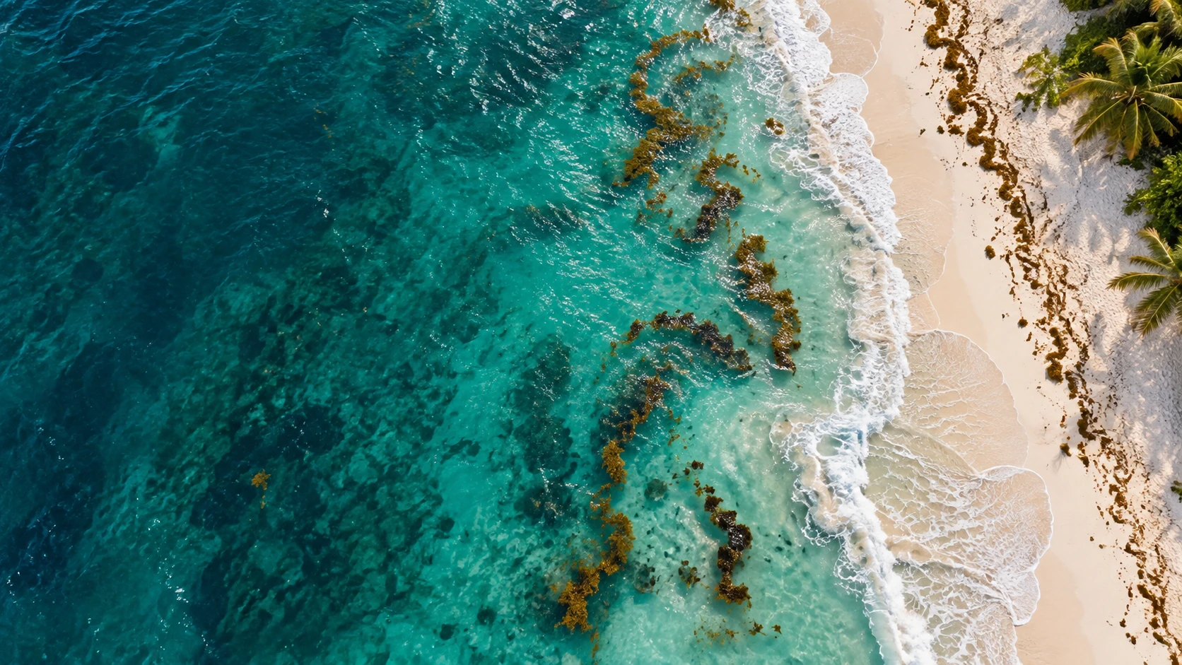
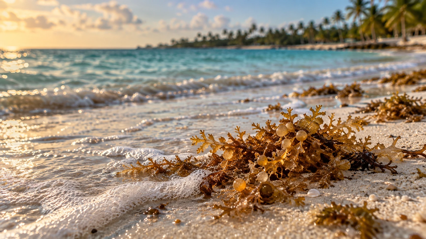
Sargassum is a floating brown macroalga. Offshore mats are natural habitat: they shelter fish, turtles, invertebrates and other marine life. The tourism problem begins when unusually large quantities reach shore, decay and interfere with swimming, fishing, coastal ecosystems and local services.
Sargassum in the Caribbean is not new, but its modern scale is. Satellite researchers describe a Great Atlantic Sargassum Belt that has appeared every summer since 2011 except 2013. In June 2018, the belt extended roughly 8,850 kilometres and contained more than 20 million metric tons. The long-term satellite pattern usually falls to a winter minimum, grows during spring and reaches a broad summer maximum.
Recent research does not support a single neat cause. Scientists examine the interaction of:
- a seed population that survives from one season to the next
- Atlantic currents and winds that aggregate and transport the algae
- temperature and salinity
- vertical mixing and nutrient availability
- climate variability, including an extreme 2009–2010 North Atlantic Oscillation
- possible land and atmospheric nutrient inputs
It is reasonable to say that circulation, environmental conditions and nutrients interact. It is not responsible to say that one river, one country or one pollution source has been proved to cause every Caribbean arrival.
Does the seaweed come from the east?
For Dominican travel planning, east and northeast exposure is a useful first approximation. Much of the floating material approaches the Caribbean from the tropical Atlantic, and easterly trade winds and regional circulation help explain why open Atlantic-facing shores can receive substantial landings.
But it is not a straight arrow from east to west. Sargassum moves in branching currents, convergences and wind-driven bands. Local conditions can turn it toward or away from a beach. A headland may shield one cove while the next open shoreline collects it. A wind reversal or storm can change a beach overnight.
The correct map therefore needs a compass and exposure zones, but it should never imply that every strand follows one identical route.
Dominican Republic seaweed season month by month
The main planning season generally runs from May through September, with June and July carrying the highest typical concern. Winter is usually quieter, but isolated arrivals can occur in any coastal month.
The concern column below is the planning model's own category for that month on the reference east coast, so it always agrees with the planner above. It is a typical-year planning guide, not a forecast for a particular date.
Use the calendar in layers. Months before travel, compare the typical seasonal pattern. One or two weeks before departure, review the offshore signal and recent regional reporting. During the last 48–72 hours, ask for a dated image of the exact beach section you will use.
| Month | Typical planning concern | What it means for a traveler |
|---|---|---|
| January | Lower | Usually one of the quieter months; check the exact beach if swimming conditions are central to the trip. |
| February | Lower | Often favorable across lower-exposure coasts. |
| March | Moderate | Early-season bands may begin to appear. |
| April | Elevated | Conditions become more variable; begin checking current reports. |
| May | High | The active planning season is underway, especially on the east coast. |
| June | High | Frequently close to the broad Atlantic seasonal maximum. |
| July | High | The climatological planning peak in the current Transekur model. |
| August | High | Large arrivals remain possible, with sharp differences between beaches. |
| September | High | East and northeast beaches still need active checking; Caribbean-facing coasts are usually lower. |
| October | Elevated | Heavy events remain possible while background pressure usually declines. |
| November | Moderate | Typically much quieter than summer. |
| December | Lower | Usually favorable, without a guarantee for every beach. |
The layered booking strategy
The best booking strategy is layered: use climatology months in advance, regional outlooks one or two weeks before travel, and recent local evidence during the final 48–72 hours.
Why two nearby beaches can look completely different
A single hotel photograph cannot describe a province. Six mechanisms explain much of the local variation:
- Shoreline orientation. An open east- or northeast-facing coast intercepts different wind and wave directions than a south-facing cove.
- Headlands and bays. A point can divert a band; a bay can either shelter water or retain floating material that enters it.
- Reefs and lagoons. Reefs may catch material offshore, alter currents or create calmer water where it accumulates.
- Wind and weather. Local wind can push a surface band onto a beach, hold it offshore or carry it alongshore.
- Timing. A beach cleaned at sunrise may look different by afternoon, and an overnight arrival can reverse that.
- Management. Barriers, collection crews, equipment and removal frequency affect the visitor experience but do not change natural exposure.
When comparing hotels, ask about the exact beach section, not merely the town.
How Punta Cana keeps sargassum away from managed beaches
The practical response combines offshore barriers, collection and pumping equipment, daily removal, research and reuse. These measures can improve a managed beach, but they do not change the coast's natural exposure or guarantee a clear shoreline.
In August 2026, a delegation from Grenada visited Punta Cana for a technical study and training programme focused on organic waste and sargassum management in the Caribbean. Participants included Grenada's ministry responsible for the blue economy and marine affairs, its national sargassum body, its solid-waste authority and the International Trade Centre. The programme was supported through the German development agency's BioWaste Caribbean work.
The group inspected floating barriers designed to intercept seaweed before it reaches shore, along with collection and pumping systems intended to bring fresher material to land. Field visits included installed barrier systems, operations at Marina La Yola, an assembly facility in Bávaro, recycling facilities and a developing plant that turns collected organic material into soil improvers. The Grupo Puntacana Foundation also presented work at its Bio-S laboratory.
The important distinction for a traveler is between natural exposure and managed beach condition. A property on an exposed shoreline may invest heavily in barriers and daily collection. A naturally lower-exposure beach may have fewer crews or less equipment. The view from the lounger depends on both.
When comparing accommodation, ask four direct questions:
- Is a floating barrier installed in front of this exact beach section?
- How often is material removed during an active week?
- Can the property send a photograph taken today, with a visible date or identifiable current condition?
- If the main beach is affected, is another usable beach or pool area available?
Source: BohioNews, 16 September 2026, reporting on the 24–28 August technical visit. The reporting is paraphrased; no source photograph or extended quotation is reproduced.
What to do if your beach is affected
Do not assume the whole country looks like one shoreline. Check a lower-exposure coast, choose an inland day or keep one flexible chauffeur day that can be decided after you see the morning conditions.
For an east-coast stay, Bayahibe and Dominicus often provide a lower-exposure comparison on the Caribbean side. La Romana and Casa de Campo sit on the same broader south-facing system. These are alternatives to check, not guaranteed escapes: verify their current condition before changing plans.
A non-beach day removes the uncertainty entirely. Santo Domingo is built around history, food and city life. The central mountains around Jarabacoa and Constanza are inland. A private chauffeur can also keep a day flexible so the destination is chosen after the latest information is available rather than weeks in advance.
If you stay at the original resort, use its managed pools, ask which part of the shoreline is currently best and avoid piles of decomposing material. Do not move or swim through heavy accumulations simply to rescue a beach day.
Related planning:
Destination-by-destination analysis
The levels below describe relative natural exposure during the main season. They do not score a hotel's cleanup program.
Punta Cana, Bávaro, Cap Cana, Macao and Uvero Alto
Punta Cana
Punta Cana is on the island's eastern tip and is one of the destinations most directly exposed to tropical Atlantic conditions. May through September deserves active checking; June and July carry the highest typical concern in this model. Winter is usually quieter.
The label Punta Cana is often used for a long, varied resort coast. A report from one property may say little about another many kilometres away. Ask for same-day imagery from the exact hotel beach and whether floating barriers or daily collection are operating.
Planning level in peak season: high.
Bávaro
Bávaro's long east-facing shoreline, reefs and lagoons make it one of the most important areas to monitor during a strong Atlantic year. The visitor experience can still differ widely because resorts manage their beach sections differently and reef openings affect local transport.
Planning level in peak season: high, and marginally the highest baseline in this editorial model.
Cap Cana
Cap Cana lies south of the core Bávaro shoreline. Its beach orientation and engineered or sheltered sections can moderate conditions in some places, but the destination remains part of the exposed east-coast system. It should not be described as immune.
Planning level in peak season: elevated to high.
Macao
Macao is an open Atlantic-facing beach north of Bávaro. Its surf and exposure are part of its appeal, but they also mean that floating bands can reach the shoreline during the active season. Because it is a public beach rather than a continuous managed resort strip, cleanup patterns may differ.
Planning level in peak season: high.
Uvero Alto
Uvero Alto sits farther northwest along the east-facing resort corridor. It remains strongly exposed during peak months. Local river discharge, beach shape and resort management can produce visible variation.
Planning level in peak season: high.
Best strategy for the eastern resort corridor: keep the resort you prefer, verify recent beach conditions, and preserve one flexible day for Bayahibe, a boat outing subject to local conditions, Santo Domingo or an inland activity.
Miches
Miches faces the northeast Atlantic and has rapidly expanded as a resort destination. Its open coast and proximity to Samaná Bay create a different geography from Bávaro, but not a no-sargassum refuge. May through September remains the main concern, with wide variation among Playa Esmeralda, Costa Esmeralda and other shoreline sections.
Planning level in peak season: high or elevated.
Punta Cana International Airport is a common gateway; Samaná El Catey may fit some itineraries. Compare the actual route before booking a flight.
Bayahibe, Dominicus, La Romana and Casa de Campo
Bayahibe and Dominicus
Bayahibe is on the Caribbean side, south and west of the island's eastern point. Its position and more sheltered water usually make it a lower-exposure choice than Bávaro or Punta Cana during the main season. That relative advantage explains why travelers often consider it for summer.
Lower exposure is not zero exposure. Winds, local circulation and large regional events can still deliver seaweed. Excursions to Saona or Catalina Island also need same-day checks because an island has multiple sides with different exposure.
Planning level in peak season: lower–moderate.
La Romana and Casa de Campo
La Romana's Caribbean-facing coast is generally less exposed than the far east. Casa de Campo contains several distinct coastal settings, including smaller protected or managed beach areas; a single regional label still cannot guarantee conditions.
Planning level in peak season: moderate for La Romana and lower–moderate to moderate for Casa de Campo.
Playa Nueva Romana
Farther west, Playa Nueva Romana remains on the south coast but has a more open shoreline than a compact sheltered cove. It is usually less exposed than the eastern tip, while occasional arrivals remain plausible in summer.
Planning level in peak season: moderate.
La Romana International Airport is closest for many La Romana, Casa de Campo and Bayahibe stays. Punta Cana also serves the region and may offer more flight choices.
Juan Dolio, Boca Chica and Santo Domingo
Juan Dolio and Guayacanes
Juan Dolio's south-facing Caribbean coast includes reef-protected sections and open gaps. It tends to have lower regional exposure than Punta Cana, yet summer landings can occur. Conditions can vary along the long beachfront.
Planning level in peak season: moderate.
Boca Chica
Boca Chica's broad shallow lagoon is protected by a reef. This can reduce wave action, but calm enclosed water may also retain floating or decaying material after it enters. Current photographs are more useful than a generic city-level report.
Planning level in peak season: lower–moderate to moderate.
Santo Domingo
Santo Domingo is primarily a history, food, culture and business destination, not a resort-beach substitute. Its south coast can receive sargassum, but a city itinerary is far less dependent on daily beach conditions. Boca Chica and Juan Dolio are common coastal add-ons.
Planning level for the coast in peak season: moderate; impact on a city trip: usually low.
Las Américas International Airport is the convenient gateway for Santo Domingo, Boca Chica and Juan Dolio.
Baní, Azua, Barahona and Bahía de las Águilas
The south and southwest receive fewer international resort visitors, but they matter to travelers who prioritize scenery, road trips and lower natural exposure.
Baní
Baní and the Peravia coast include dunes, salt landscapes and beaches with varied orientation. Relative exposure is generally lower than the east coast. Facilities and cleanup can be limited, so even a smaller arrival may remain visible longer.
Planning level in peak season: lower–moderate.
Azua
Azua lies on a sheltered southern bay behind major headlands. This geography usually reduces direct Atlantic exposure, although local accumulation is still possible.
Planning level in peak season: lower–moderate.
Barahona
Barahona's coast combines open Caribbean shoreline, pebble beaches, cliffs and small coves. Relative exposure is low in this model, but remoteness, waves and limited maintenance should factor into beach selection.
Planning level in peak season: lower–moderate.
Pedernales and Bahía de las Águilas
Bahía de las Águilas is in the far southwest near the Haitian border. It is remote, lightly developed and typically among the lower-exposure choices in the country. That is not a cleanliness guarantee: natural debris can remain where there is little mechanical maintenance, and the long road journey requires planning.
Planning level in peak season: low.
Explore Pedernales and Bahía de las Águilas transportation.
For the southwest, Las Américas International Airport is the usual international gateway, followed by a substantial road transfer. Build the itinerary around travel time, fuel, food, guides and road conditions rather than seaweed alone.
Las Terrenas, El Limón, Las Galeras and Samaná Bay
The Samaná Peninsula is too geographically varied for one rating.
Las Terrenas
Las Terrenas is on the peninsula's north coast. Headlands, reefs and the orientation of individual beaches create major differences between Playa Bonita, Punta Popy, Cosón and neighboring sections. The region has meaningful summer exposure but generally not the same baseline as the most exposed eastern corridor.
Planning level in peak season: moderate.
El Limón
El Limón's nearby north and northeast-facing shores are more open. The area has strong inland attractions, including the waterfall, so a visit does not have to depend entirely on the beach.
Planning level in peak season: elevated.
Las Galeras
Las Galeras sits near the exposed eastern end of the peninsula. Some beaches face open Atlantic sectors while others are tucked into bays; therefore, the village-level average hides substantial variation.
Planning level in peak season: elevated to high.
Samaná Bay
The bay is partly enclosed, so its behavior depends on entrances, internal currents, wind and the specific shore. It may be less directly exposed than an outer Atlantic beach, yet floating material that enters can collect locally.
Planning level in peak season: moderate.
Explore Samaná transportation.
Samaná El Catey Airport is the closest scheduled international gateway for many peninsula stays; Las Américas is a practical alternative for certain flight schedules and road itineraries.
Puerto Plata, Sosúa, Cabarete, Río San Juan and Montecristi
The north coast faces the Atlantic but is farther from the main east-coast resort corridor and interacts with different currents, trade winds and coastal shapes. It is not automatically seaweed-free.
Puerto Plata
Puerto Plata mixes resort beaches, city attractions and mountain experiences. Playa Dorada and Costa Dorada have different management from public beaches, and the cable-car area, historic center and inland excursions are not beach dependent.
Planning level in peak season: moderate.
Sosúa
Sosúa Bay has a curved, partly sheltered form. Its relative exposure is lower than open north-coast surf beaches, but the bay can retain floating material that enters.
Planning level in peak season: moderate or lower–moderate.
Cabarete
Cabarete's open wind and wave setting is central to its water-sports identity. The same exposure makes local wind-driven arrivals possible. Water-sports conditions and sargassum conditions should both be checked.
Planning level in peak season: moderate.
Río San Juan and Playa Grande
This area combines protected lagoons, coves and open Atlantic beaches. Rate each excursion separately rather than treating the whole municipality as one beach.
Planning level in peak season: moderate to elevated.
Montecristi
The far northwest is removed from the eastern Atlantic-facing resort arc and includes bays, mangroves, cays and dry coastal landscapes. It has low relative exposure in this model but limited large-scale beach maintenance.
Planning level in peak season: lower–moderate.
Gregorio Luperón International Airport serves Puerto Plata, Sosúa and Cabarete most directly. Cibao International Airport in Santiago can make sense for combined north-coast and Cibao trips.
Santiago, Jarabacoa, Constanza and La Vega
These inland destinations have no beach-sargassum exposure.
- Santiago offers culture, restaurants, baseball history, tobacco heritage and a city base.
- Jarabacoa offers rivers, rafting, waterfalls, hiking and mountain air.
- Constanza offers a high valley, farms and access to mountain landscapes.
- La Vega connects Cibao culture with central-mountain routes.
They are especially useful during summer for travelers who value nature or culture more than an all-beach holiday. This does not mean the weather is guaranteed; rain, heat and hurricane-season planning still matter.
Cibao International Airport is the closest international airport for Santiago and commonly the most convenient for Jarabacoa and La Vega. Santo Domingo can also work, depending on flights and the road itinerary.
Which destination is best by season?
This is not a ranking of overall quality. Punta Cana may still be the best trip for a traveler who values direct flights, a particular resort and excellent cleanup. A remote lower-exposure beach may have fewer services, a longer transfer and little mechanical cleaning.
| Travel period | If beach is essential | If minimizing sargassum matters most |
|---|---|---|
| January–February | Most coasts are reasonable candidates | Choose by resort, weather and flight convenience |
| March–April | Verify eastern and northeastern beaches | Consider Bayahibe, La Romana, southwest or north-coast coves |
| May–July | Select the exact managed beach, not just a town | Prefer lower-exposure Caribbean or southwest options; add inland days |
| August–September | Maintain flexible plans and recent checks | Bayahibe/La Romana, southwest, or mountains are stronger planning candidates |
| October | Conditions usually ease but can remain episodic | Combine a coast with city or mountain flexibility |
| November–December | Broadly quieter on most coasts | Choose based on the complete trip rather than sargassum alone |
How to check the exact beach before you travel
Seven to fourteen days before
- Read the latest regional bulletin for background pressure.
- Ask the hotel which named beach section it manages.
- Request information on barriers, collection frequency and recent large arrivals.
- Identify one alternative beach or inland day.
Forty-eight to seventy-two hours before
- Look for recent, date-stamped photographs or video from the exact beach.
- Compare more than one source: hotel, local operator and recent visitor imagery.
- Check wind and marine weather.
- Do not rely on an undated social-media clip.
The morning of a beach day
- Ask a reliable local contact about the shoreline.
- Check whether overnight wind changed.
- Confirm boat and beach conditions before a long transfer.
This three-stage method is more useful than any annual list of supposedly seaweed-free beaches.
Health and safety
Fresh sargassum offshore is not the same as a large decaying pile on land. The United States Environmental Protection Agency explains that decomposition can begin producing hydrogen sulfide and ammonia after roughly 48 hours. Exposure near dense decomposing accumulations may irritate eyes and airways or cause headache, nausea and dizziness. Children, older adults and people with asthma or other respiratory conditions can be more sensitive.
Practical precautions:
- Avoid entering dense floating mats.
- Do not let children play in decomposing piles.
- Leave the immediate area if a rotten-egg odor is strong or symptoms begin.
- Ask hotel staff or a medical professional for help when symptoms persist.
- Do not collect sargassum for food, skin products or home fertilizer; it can contain contaminants, including arsenic.
This section is general travel information, not medical advice.
Plan the trip, not just the beach
The right destination depends on flights, transfer time, resort style, excursions and tolerance for uncertainty. Transekur provides private airport transfers from the principal international gateways serving these regions: Punta Cana, Santo Domingo, La Romana, Santiago, Puerto Plata and Samaná El Catey.
Reserve a private airport transfer and share the flight number so the arrival can be monitored.
If you want a flexible lower-exposure beach, city or mountain day, book a private chauffeur instead of committing to a rigid group excursion.
Transekur also offers VIP Fast Track at PUJ, SDQ, POP, STI and LRM. Samaná El Catey is listed as coming soon, so confirm current availability before purchase.
For the arrival ride, add selected drinks to your transportation during the booking flow. Cold water, soft drinks, Wi-Fi and USB charging come standard on every trip, while selected extras make celebrations or longer road transfers more comfortable.
Methodology: what the Planning Index means
The calculator combines two editorial inputs:
- A monthly pressure curve based on the recurring Atlantic seasonal cycle.
- A relative exposure weight for each destination, based on coast orientation, openness and regional geography.
The score equals monthly pressure multiplied by destination exposure, divided by 100 and rounded. It is a comparative index from 0 to 100. It is not a measured percent probability. It does not include a hotel's cleanup capability, a live satellite forecast, daily wind or a guarantee.
The model assigns zero only to inland destinations, which are shown as not applicable. Every coast remains capable of receiving floating sargassum. Model values are versioned; any change is dated in the update log below.
Estimate for your exact resort
Resort mode is designed to search the exact hotel, verify its coordinates and assign its actual beach or coastal segment — not simply the nearest town — reporting the reference coast, distance and a confidence grade. If a reception building is inland or the property uses a separate beach club, the beach itself is what gets assigned.
In its current stage, the search above recognises the resorts already in Transekur's transfer inventory and returns a clearly labelled provisional estimate from the property's coordinates. Reviewed beach-access pins and confidence grades follow; an ambiguous property returns Unknown rather than a guess.
This remains a natural-exposure estimate. A resort's barriers and cleanup will appear as a separate, timestamped visitor-condition report once observations are collected.
Updates for your travel date
A precise resort forecast three weeks ahead is not scientifically defensible. The evidence that can honestly be offered becomes more specific as arrival approaches:
- more than 30 days: climatology and seasonal outlook
- 15–30 days: broad regional trend
- 8–14 days: experimental coastal signal, only after private validation
- up to seven days: licensed and validated coastal risk or drift evidence
- final 72–24 hours: daily satellite or risk fields and recent local observations
Today this page publishes the climatology layer. Live satellite layers, first-party beach observations and Transekur Sargassum Trip Alerts are being built and will only appear here after they have been validated against real shoreline observations. Until then, the three-stage check described above is the reliable method.
Conclusion
The clearest Dominican pattern is geographic and seasonal: concern rises during spring, normally peaks in early to midsummer and is greatest along many east- and northeast-facing shores. Bayahibe, La Romana, parts of the south and southwest and some protected northern settings are generally lower-exposure alternatives, while the central mountains remove beach sargassum from the decision entirely.
Use that pattern to choose a region. Then use current, beach-specific evidence to choose the day.
Wherever the answer takes you, plan the ground journey with Transekur.
Scientific sources
- University of South Florida Sargassum Watch System
- USF June 2026 Sargassum Outlook Bulletin
- USF July 2026 Sargassum Outlook Bulletin
- NASA Earth Observatory: Sizing Up the Sargassum Belt
- Science: The Great Atlantic Sargassum Belt
- EPA: Origin and Drivers of the Great Atlantic Sargassum Belt
- EPA: Sargassum inundation events and human health
- NOAA CoastWatch ERDDAP 7-day AFAI
- NOAA Daily Sargassum Inundation Risk v1.5
- Dominican Republic National Contingency Plan for Sargassum
- ANAMAR official sargassum publications
Regional bulletins are cited and linked, never reproduced. USF states that its outlook must not be used to predict a specific beach; this guide follows that rule.
Update log
- — First publication. Baseline model 1.0.0 (climatology only). Map geometry from geoBoundaries DOM ADM0 (CC BY 4.0) with Natural Earth context. Live satellite layers, beach observations and trip alerts not enabled.
- — Editorial rewrite of the headline, deck, introduction, month explainer and FAQ. The deck's month and band, and the month table's concern column, are now computed from model 1.0.0 itself instead of written by hand. Added a beach-management section (Grenada technical visit, BohioNews, 16 September 2026) and a what-to-do-if-your-beach-is-affected section. Model values, destination analysis, methodology and sources unchanged.
Model changelog
- 1.0.0 · 2026-08-21 — Initial published baseline: 12 monthly pressure values, 26 coastal destinations with exposure weights, 4 inland destinations at weight 0, four categories (0–19 Lower, 20–39 Moderate, 40–59 Elevated, 60–100 High).
Frequently asked questions
- Is there sargassum in the Dominican Republic in September?
- Yes, September remains active on exposed east- and northeast-facing coasts. Bayahibe, La Romana and the southwest usually have lower seasonal exposure. Conditions still vary by beach and day, so confirm your exact shoreline close to travel.
- Which Dominican Republic beaches usually have less seaweed?
- Caribbean-facing Bayahibe and La Romana, plus the far southwest, usually carry a lower seasonal baseline than Punta Cana and Bávaro. “Lower” does not mean guaranteed clear; local weather and management still matter.
- Is sargassum dangerous?
- Floating sargassum offshore is important marine habitat. Large piles decomposing on land can smell and may irritate some people. Keep children and pets away from heavy accumulations and follow the property's local guidance.
- Why does beached sargassum smell?
- The odor comes as stranded seaweed decomposes. Fresh material offshore or newly collected material is different from a pile that has remained on a warm beach.
- Do Dominican resorts clean sargassum from the beach?
- Many managed resorts use crews, equipment and, in some locations, offshore barriers. The level of management differs by property and beach section, so ask for current details rather than assuming every resort operates the same way.
- Can I still swim when sargassum is present?
- Often yes, when the water is open and the accumulation is light. Avoid dense or decomposing material and follow beach flags and local staff instructions. A heavy landing can make another beach or a pool the better choice that day.
- Can anyone guarantee a seaweed-free beach?
- No. Seasonal patterns help with planning, but wind, currents and overnight arrivals can change one beach quickly. Use current dated evidence for the final decision.
- How do I check my exact resort beach before I fly?
- Use the planner for seasonal context, review the current offshore signal, then request a same-day photograph from the property during the last 48–72 hours. Match every report to the exact resort and beach section.
- Is sargassum better in the Dominican Republic or Mexico's Caribbean coast?
- Both share the same May to September season, but conditions vary by beach. For Cancún, Playa del Carmen and Tulum, see How Is The Sargassum?'s 2026 sargassum outlook.

Plan the ground journey, whatever the beach decides
Private airport transfers from PUJ, SDQ, LRM, STI, POP and AZS, flight-tracked, with a private chauffeur available for the flexible beach, city or mountain day this guide recommends.
Get a quote